Self-driving through Namibia: 10 days

Read my Brain:
✿ This symbol means… it’s Really worth doing!
✎ This symbol means… it’s Not worth it, unless you have time to spare!

Intoduction to
Namibia
Wonderful landscapes you won’t see anywhere else. You will wonder: did I land on another planet? Where did humanity go? Did we become extinct and I did not notice?
Namibia is the “Land of Nothing” - this is what their South African neighbors like to call this country. And I can see why! You can drive for hours without encountering a human being, a car, or an animal. Most of the roads you will drive on will welcome you with some wild animals crossing, no phone connection, dust all around you and a tree making some shadow here and there. You definitely will feel the freedom, breathing air, relaxation and immensity when being here.
This is Namibia in a few words. But there is much more, which I hope to tell you all about in this blog article.
One note though, which was one of the main points of conversations with my travel friends at the end of our trip: landscapes are unique, but one cannot say the same about their culture. May it be because of their history (a country that was just born recently, 1990), their lack of population density (not even 3 million on their entire land), or simply the cultural diversity (a country inhabited by people of opposite cultures - german, dutch, African…)… they lack culture. They don’t have many traditions that you, as a visitor, can grasp when being there. This was sad, I usually love to live the culture of a place I visit. But at the same time, the nature you will experience there will take your breath away, and will wipe away all your thoughts about anything else!
One additional note: Namibia might be dangerous if you don’t have a survival spirit, so be aware that if you want nature and landscapes that are untouched, authentic and savage, you cannot expect to have high-end services that will help you in problematic situations. You shall be your own savior! You should be able to change a broken wheel, sleep without many comforts and so on.
And don’t forget to always salute the locals with “Hey how are you?”, this way you’ll blend with locals, and avoid perhaps some non-sense driving tickets and fines they usually make to tourists!

Your perfect plan for
10 days in Namibia
To do our same tour, you will need 10 full days approximately.
REMINDER: This blog allocates experiences in the way that saves the most time (spent on reaching areas) and energy! Isn’t it great? <3 ).
DAY 1
✈️ Fly and Arrive
DAY 2
Sesriem: Solitaire, Sesriem Campsite & Canyon
DAY 3
Sesriem: Deadvlei & Soussvlei
DAY 4
Kuiseb Canyon & Walvis Bay
DAY 5
Sandwich Harbor & Swakopmund
DAY 6
Spitzkoppe
DAY 7
Twyfelfontein
DAY 8
Etosha National Park - Okaukuejo
DAY 9
Etosha National Park - Halali
DAY 10
The luxury of Namibia
DAY 11
✈️ Fly back home
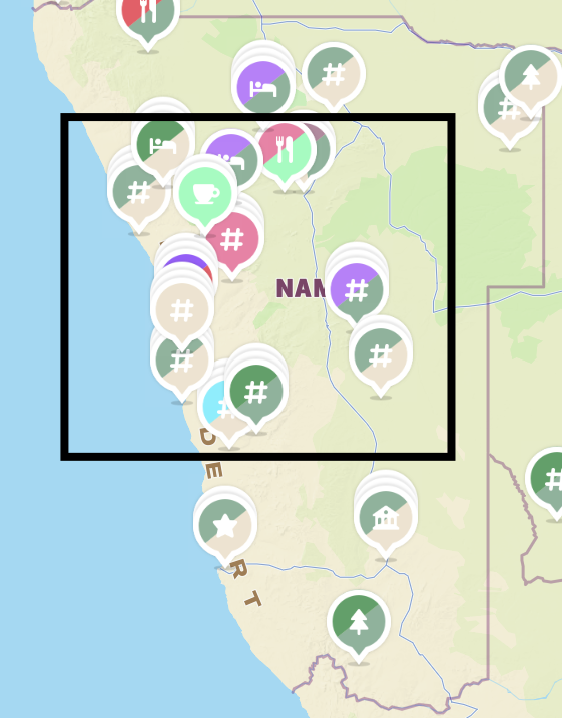
If you wish to find my map pins and easily follow them, follow me on mapstr!
IMPORTANT:
All you need to know
before travelling to Namibia
-
If you are doing a Self-Driving trip to Namibia, you must rent a 4×4 car. If you will choose, like us, to have some campsites experiences, then you must choose the 4×4 SUV with tents on top. We slept in 3 into 1 tent, but usually each tent accomodates 2 people.
WHERE TO RENT YOUR 4X4 SUV WITH TENT:
We have booked our car with Travel Namibia. I have to say, it was overall good, even though we had some minor issues.
Otherwise, I know most people rent it here with Namibia2go, it’s more expensive but it’s a great option.
Consider a full insurance coverage, it’s very common to break car pieces in Namibia’s gavel roads, to break your glass and other issues. Having an insurance here is more important than any other place.
IMPORTANT THINGS TO KNOW:
The international driving license is NOT required (as of today, 2024) - though, if you feel safer and want to do it, then you can apply for an International Driving License here. No one ever asked us for it, and our car rental agency also told us our normal Italian driving licenses were good enough. BUT, what I rather strongly recommend you to do, which is what we did too, is to get yourself a “Authentication of the driving license”. You can send an email here at the Republic of Namibia Consulate in Italy to apply for the procedure to obtain this authentication. This is faster and cheaper (50€) than the international driving license.
Driving in Namibia is not easy. The roads are bumpy, mostly broken, the wheels will just go their own way if you don’t hold onto the steering wheel very hard. The daily routes are very long, you could drive up to 4h a day. So make sure you are aware of this!
Make sure to download the offline Namibia Maps on Google or other apps. Even if you opt for a local sim card, there won’t be signal for hours sometimes. This makes it hard to know where to go and how to reach your next destination.
You might drive for hours without encountering any person. Therefore, you must be prepared at anything: like changing wheels, fixing car issues, having enough food & water supplies etc. The important is for you to be aware of this!
These cars consume a lot of gasoline. So consider allocating quite some money on gasoline for this trip! Cars usually have 2 tanks, so the gasoline should last you for quite some hours.
When driving on the gravel roads, make sure to always keep a distance from other cars, because their wheels will throw rocks at your glass and break it.
TO CHECK BEFORE RENTAL:
Be careful with all the explanations they give you when renting it, they are very important:
Road rules: there are police checkpoints that will fine you if you overspeed, or lack a seatbelt. Make sure to always follow speed limits signs.
How to change a wheel, which can break with the bumpy roads of Namibia.
Make sure to have the wheels substitutes.
Make sure to have the pump to inflate and deflate your tires - this is fundamental when driving in the desert!
Check your wheels status, they must not be too consumed, your breaks.
Check what’s included within the “equipment” of your car, Ours lacked towels, and other things, which might be useful during your stay. Make sure to ask and be aware of what’s missing.
TO DO DURING YOUR TRIP:
When driving on the Desert dunes, set your SUV to option “4×4”, and make sure you deflate the wheels to 1.6-1.8. You really need to deflate so that your vehicle 'floats' on the sand. When you are back on the normal road, pump back the wheels to 2.0. Don’t worry, if you don’t know how, you can ask locals at the dunes park entries to help you out with it. Just make sure you know about it! Additional information about tires: when driving on the dunes of sand (like on the Sandwich Harbor) - just in case you want to self-drive there and not go with local agencies (you can read more about this in the blog below) - you will need to deflate your tires to 0.8! So that the wheels really can grip into the deep sand.
Make sure you always refuel your car at every petrol station you find. Even when you are almost full. This is important because you won’t find many petrol stations, sometimes you will drive hours to find one.
Make sure to always respect the road rules, especially around the main cities (like Windhoek), the police officers will ALWAYS try to scam you and make you pay fines as soon as they see you are a tourist. And they won’t forgive, the only thing they will do is not “legally fine you” but force you to pay an “amount” to “silence the fine”… which is anyway just a way to pocket money…
Remember to always take your blankets, bed sheets and pillows out of the tent before closing it and departing for the day. The humidity that stays inside the tent will make your bed sheets wet, and smelly. The once you open your tent for the night, You can insert back all the bedding.
Make sure to keep the High Beams turned on during your driving! The blue road sign indicating the use of high beams in Namibia alerts drivers to the necessity of using high beams in specific areas to enhance visibility and ensure road safety.
Drivers must turn on their high beams to make themselves more visible to other vehicles, especially on gravel roads or poorly lit areas.
-
Do not drive at night. There are no street lamps, so the visibility is very low. Animals cross constantly in many areas, and at night you won’t see them until last minute, so you might end up in a crash which is not pleasing. What I suggest is to rather drive only up until Sunset. This is actually the best moment 😍, the sky is beautiful, and there are more animals!
Start your days early! Most of the visitable places close at 5pm! Some campsites or national parks close their gates at sunset… plus there isn’t any night life in Namibia. So you better start your days earlier, enjoy the day, and rest in the evening or night!
When visiting Namibia, commonly salute the people there with a cheerful "Hey, how are you?" as a way of acknowledging others and showing respect. This informal greeting is not just polite—it’s a cultural norm that reflects the country’s emphasis on community and friendliness. By starting your interactions this way, you’ll not only avoid standing out as a tourist but also make a positive impression, fostering genuine connections during your trip.
Make sure to do your grocery shopping as soon as you arrive in Windhoek. Why? Simply because you won’t encounter any supermarket for days afterwards so you need to get everything you might need for your trip, or at least half of it.
You can buy a local sim card as soon as you land, at the airport. The company is MTC. It works very well, in the areas where the signal is. But be aware that many many areas in the open desert have zero signal for hours…
Exchange your cash directly at the airport as soon as you land. Many places in Namibia will just accept cash, so make sure you consider enough cash for your trip.
If you are flying with one or multiple layovers (we did one in Johannesburg) make sure to reach out the new gate quite fast, they tend to have very short layover time, and the airports in Africa are big, disorganized and close the gates at the time they say, therefore you might lose your flight!
The temperatures vary a lot between the various places you’ll visit. The desert is very hot during the day, but the wind gets cold at night. The coastal cities are very cold, and the wind is super strong here since they are by the ocean.
Accommodations are limited across the country. To ensure you have affordable but high quality places, make sure to book your stays well in advance.
The best campsites around Namibia are the ones from NWR - Namibia Wildlife Resorts. They have multiple campsites & resorts across the country, they offer wifi, a common area, their campsites are very equipped and overall they were the best ones we have experienced whilst there.
Plastic bags are not allowed in the National Park of Etosha, and other parks too. Make sure to bring tote bags or bags in general to keep your grocery and things, otherwise they will fine you! They always check your car seats & trunk when entering or exiting the parks.
-
English is their official language - most inhabitants, even in the deserts, can speak english fluently there.
Other languages spoken are: Akrikaans, Oshiwambo (also called Ovambo) and others.
Namibia was a German colony known as German South West Africa from the late 19th century until 1915. While the Netherlands did not colonize Namibia, European powers, including Germany and the Netherlands, were part of the broader colonial system that shaped the region. Afrikaners are descendants of Dutch settlers who established themselves in South Africa beginning in the 17th century.
Afrikaans language retains a large portion of its vocabulary from Dutch, with around 90% of its words stemming from Dutch. However, the grammar has been simplified.
Namibia was under South African control from 1915 to 1990, following a League of Nations mandate after World War I. Though, South Africa treated Namibia as an extension of its territory, imposing racial segregation and apartheid policies. This is why indigenous Namibians faced disenfranchisement, land dispossession, and forced labor, and why resistance grew, leading to an armed struggle for independence. International pressure and UN resolutions declared South Africa's occupation illegal, leading to a peace agreement. Namibia achieved independence on March 21, 1990, ending decades of oppression and beginning its journey as a democratic nation.
South Africans call Namibia “The Land of Nothing”. And you will see why, it’s deserted for most parts, there is literally nothing in most of the country land.
Diamond mining and fishing are among the most dangerous professions in Namibia, which is why they are often well-compensated. In the diamond mining sector, workers face significant physical hazards, including the risk of cave-ins, heavy machinery accidents, and exposure to dust and chemicals that can harm their health over time. Offshore diamond mining, especially along Namibia's rugged Skeleton Coast, adds another layer of danger due to unpredictable weather and treacherous sea conditions. Similarly, the fishing industry involves long hours at sea, navigating rough waters, and operating heavy equipment, all while contending with the ever-present risk of accidents.
Namibia is one of the greatest achievements in the world for the preservation of the stars thanks to the mancanza of luminous equipment. So whenever you are in a national park, camping, make sure to watch the sky and dedicate some time to drink something and enjoy the sky! You can find more info in this blog in a dedicated section to where you can see the stars!
A Flag Full of Symbols! Namibia’s colorful flag is rich in symbolism: blue represents the sky and marine resources, red symbolizes the people, green stands for the country’s scarce but vital vegetation, and yellow represents the ever-shining sun.
Unusual Festivals in Namibia? Namibia celebrates a unique festival called "Wika", a German-style carnival featuring extravagant costumes and parades. A legacy of the country’s colonial past, it remains one of the most unusual and lively cultural events in Namibia. If you happen to visit Namibia during April, then you should definitely attend this!
-
During its time as a German colony (1884–1915), Namibia adopted German brewing traditions. Many of its early breweries were founded by German settlers. The most famous beers in Namibia are: Windhoek Lager. Tafel Lager, Hansa Draught.
The Windhoek Lager beer was brewed according to the 1516 German Purity Law (Reinheitsgebot). Made with only malted barley, hops, and water.
You must try Biltong: a traditional snack in Namibia. Made from beef or game meats like kudu, springbok, or oryx, it is cured with vinegar, salt, and spices such as coriander before being air-dried to perfection. Biltong is distinguished by its tangy and aromatic flavor. It’s widely enjoyed as a high-protein snack during social gatherings, road trips, or as part of a meal!
Koeksisters are a beloved South African and Namibian pastry, known for their crispy, golden exterior and sticky, syrupy sweetness. These deep-fried, twisted dough pastries are soaked in a cold sugar syrup immediately after frying, giving them their signature glossy sheen and chewy texture. Their name comes from the Dutch word koek (meaning "cake") and reflects Namibia’s historical ties to Afrikaans and Dutch culinary traditions.
Sedgwick’s Old Brown is a fortified wine (not a brandy, despite common belief). Originally from South Africa, this sweet, warming, and rich dessert wine is often enjoyed straight, mixed with coffee, or even added to campfire drinks while on safari. Its slightly spicy, caramelized taste makes it a staple for those exploring Namibia’s desert landscapes, where chilly nights call for a comforting drink.
-
Start listening to their songs & learn them before travelling there. They are also a great buddy for your road trips! Here are the best titles: “Ndihamba Nawe”, “Loslappie”, “Bhebha”, “Skuta Baba”.
Ask locals to sing a "Happy Birthday" song to you, you’ll be surprised! Birthday wishes may incorporate poetic or heartfelt phrases reflecting the country’s connection to nature and community.
For example, phrases like "May the sun above you shine upon you," "May the winds carry your dreams far," or "May the rains bless your path" are expressions of good wishes which align with the local appreciation of life’s milestones and the beauty of the land.
Rooibos tea, derived from the leaves of the Aspalathus linearis plant, is indigenous to South Africa, rbbut has become widely appreciated in Namibia for its naturally sweet, earthy flavor and numerous health benefits, including its rich antioxidants and lack of caffeine.
The Red Cappuccino, is a caffeine-free alternative to the traditional cappuccino in Namibia. Made by brewing concentrated rooibos tea and topping it with frothy steamed milk, it’s often served with a sprinkle of cinnamon or honey.
Try their Marula oil, a plant-based oil extracted from the seeds or pulp of the fruit of the Marula tree (Sclerocarya birrea), native to sub-Saharan Africa. Renowned for its exceptional hydrating, antioxidant, and nourishing properties, it’s rich in essential fatty acids such as oleic and linoleic acid, as well as vitamins C and E. Marula oil serves as an excellent moisturizer and protector for both skin and hair. In Namibia, a leading producer of Marula oil, the tree thrives in the arid and semi-arid conditions of the region.
-
Something I did definite undervalued before going to Namibia, but was one of the best object we had especially in the Etosha park: Binoculars!
Don’t forget to bring with you a hair dryer! You will have difficulties finding it around the campsites!
You want to bring a very light pijama to sleep in the tent. Why? Yes it gets much colder at night in Namibia, but in the tent, you will soon be hot and sweat because of the isolating materials it’s made of!
It's essential to pack the right plug adapter. Namibia primarily uses plug types D and M, which have three round pins in a triangular configuration.
Make sure to bring all useful meds you might need. There are no pharmacies for most of the time (only in Windhoek, Swakopmund & Walvis Bay), so you will need to either bring them with you, or buy them in Windhoek. Something useful: meds for your throat, you might get a cold with the temperatures changes, and thermal shocks there.
Bring your portable charger! There are basically no plugs in the resort rooms you will stay in. Most of the time they have no plug in the bathroom, and maybe one in the entire house, chalet or room.
I am building a wardobe guide for this trip - stay in the loop!
LET’S GO…
NAMIBIA
Day 1
Fly & arrive
✿ Sleep in Windhoek
Here are some options:
✿ Rent a car in Windhoek
Click here to go to my “All you need to know” section, where you will find all the information about where to rent it, how to and what to know before and during the rental of a tented-4x4-car in Namibia.
✿ Buy a local SIM card at the airport or in the city
Click here to go to my “All you need to know” section, where you will find all information about where to get it.
Day 2
Sesriem: Solitaire, Sesriem Campsite & Canyon

If you wish to find my map pins and easily follow them during your trip, follow me on mapstr!
✿
Drive through Spreetshoogte Pass
Start your road-trip from Windhoek down towards Sesriem. You should pass by the Spreetshoogte Pass, a beautiful road through the desert with probably the best views I had in Namibia.
It’s an up and down road, so your breaks will suffer a little, but it’s worth it!


You will encounter these road signals on the way. I find them very unique and representative of the emptiness of this nature. The sole presence of a tree with some shadow to real under, is to be communicated.

✿
Apple Pie in Solitaire
During this road trip stop in Solitaire. Nestled in the heart of the Namib Desert, Solitaire is a tiny settlement known for its rustic charm, old gas pumps, and a bakery famous for its mouthwatering apple pie. Whilst here, you cannot miss their iconic pie at McGregor’s Bakery. The pie gained international fame thanks to its creator, the late Moose McGregor, who perfected the recipe that combines a golden, flaky crust with a rich, spiced apple filling.
At the bakery, they also sell other sweets and some ready-made cookies!


✿
Shop Souvenirs in Solitaire
By the way, if you want to shop some souvenirs, this was the cheapest place we could find in Namibia! Meaning: the same exact things you would find them around Namibia at a higher price, so if you like any of the souvenirs they have in the city of Solitaire, take advantage and do not procastinate!


✿
Trek inside the Sesriem Canyon
Easily accessible from the Sesriem Gate, the canyon features towering rock walls carved by the Tsauchab River over millions of years. You can descend into the narrow canyon to explore its unique terrain and discover ancient sedimentary layers. The best times to visit are early morning or late afternoon, when the light highlights the canyon's beauty, and the temperatures are more comfortable.
You will need to pay the park entry ticket in order to visit the canyon. Exploring the canyon usually takes 30 minutes to 1 hour, depending on how much of the canyon you want to cover.
✿
Sleep at NWR Sesriem Campsite
For this night, you should book the NWR Sesriem Campsite, because it’s very close to your next day destination, the one you should reach by dawn. So you want to be close to it, to avoid long drives for the day after.
✿
Watch the sky & the stars, NamibRand Dark Sky Reserve
The Croce del Sud (Southern Cross) is one of the most famous and easily recognizable constellations in the southern hemisphere. It consists of four bright stars forming a distinctive cross shape and has been used for centuries by navigators to determine the south celestial pole.
The NamibRand Dark Sky Reserve is even certified as an International Dark Sky Reserve, one of the few in the world, making it an exceptional spot to see the Croce del Sud and the dazzling Milky Way with the naked eye.


Day 3
Sesriem: Deadvlei & Soussvlei
You can find the full Google Maps itinerary for this day at this link.

If you wish to find my map pins and easily follow them during your trip, follow me on mapstr!
✿
Drive at sunrise from Sesriem to Sossusvlei
The drive at sunrise is beautiful and you can see the dunes covered from different colors!

BEFORE ENTERING the Soussvlei:
Make sure to ask locals there to deflate your tires to 1.8 - here you can activate the 4x4 function of your car finally and drive easily on the Soussvlei desert dunes!
The park entrance is around 8€ each (we paid 500 NAD for 3 people)
The park opens every day at 5am and closes at sunset (which during Jan when we were there, it was around 19.30 in the evening).
✿ Sunrise on Big Daddy Dune
The Big Daddy is a dune with an amazing viewpoint. If you suffer from dizziness, then it’s probably not your place to be. I do suffer from it, but I luckily had two amazing friends who were supporting me all over the top (probably lying, telling me we were there, even when we weren’t… but hey, it worked!).
And I say luckily because the top was worth it.
For two main reasons:
The stunning view. Probably my favourite view in all of Namibia. That view you feel it’s Namibia.
The following run down the dunes. You can descend from the other side, and go to the next point. We did it running, and it was super fun!
Some good information:
You need to go here at sunrise because when the sun hits, the dune hiking becomes harder! We woke up at 4. Left at 4.30, we were there at the starting point at around 530 and started hiking.
Bring water!
Take off your shoes, climbing up is much easier!
Don’t do the touristic usual route, rather, follow ours! We stole the idea from some people there, and we were happy we did it! You basically save yourself all the initial part of the Big Daddy which isn’t that great, you save energy, time and go straight to the great part! To do so, walk from the parking point here, towards the green arrow in my chart below. Do not follow the red path which is the touristic one.


✿
Deadvlei: black, white, orange and blue!
You can run down the dunes from the Big Daddy and reach the white, blue, black and orange valley, the Deadvlei. Literally, these colours clash so elegantly there!

Formed over 900 years ago when the Tsauchab River dried up, it left behind a forest of ancient camel thorn trees, now blackened by the sun and standing eerily against the cracked white clay. Despite its lifeless appearance, the name "Deadvlei" means "dead marsh" due to the presence of dark tree skeletons. The trees have not decomposed due to the extreme dryness of the area, preserving this ghostly landscape for centuries.
Camel thorn trees are usually well adapted to arid environments, with deep roots that can reach underground water sources. However, when the shifting dunes of the Namib cut off Deadvlei from the Tsauchab River, the trees were unable to survive. Despite their death centuries ago, they remain perfectly preserved, as the climate is too dry for decomposition.
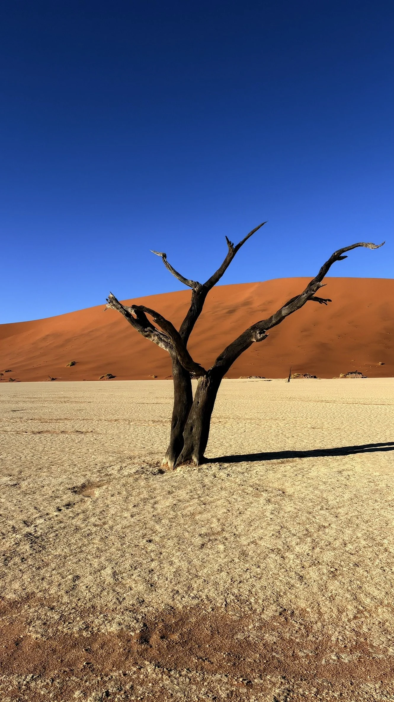


The camel thorn tree (Vachellia erioloba) is one of the most resilient and iconic trees of the Namibian desert, thriving in some of the harshest conditions on Earth. Unlike the lifeless, blackened camel thorn trees of Deadvlei, living camel thorns are lush and provide vital shade and sustenance in arid landscapes. These trees are incredibly well adapted, with deep taproots that can reach groundwater over 50 meters below the surface, allowing them to survive in extreme drought conditions. Their small, tough leaflets minimize water loss, while their seed pods are an essential food source for desert wildlife, including elephants, antelope, and even humans.

✿
Picnic in Soussvlei
At the parking area, there is a nice spot with tables under the trees to relax and enjoy a picnic!

✎
Dune 45
If you still feel like hiking, which I doubt after the Big Daddy, you can also visit this other view point on Dune 45, way easier.
✿
Relax and enjoy the pool by the desert at Namib Desert Lodge
After this day, you deserve some relax! We have booked this hotel, which had a great view and pool by the desert, and also the best local meals we had in the country!


They also have cute souvenirs!


We spent our NYE here, played some nice local board games and danced their local music! The people working here are real nice!


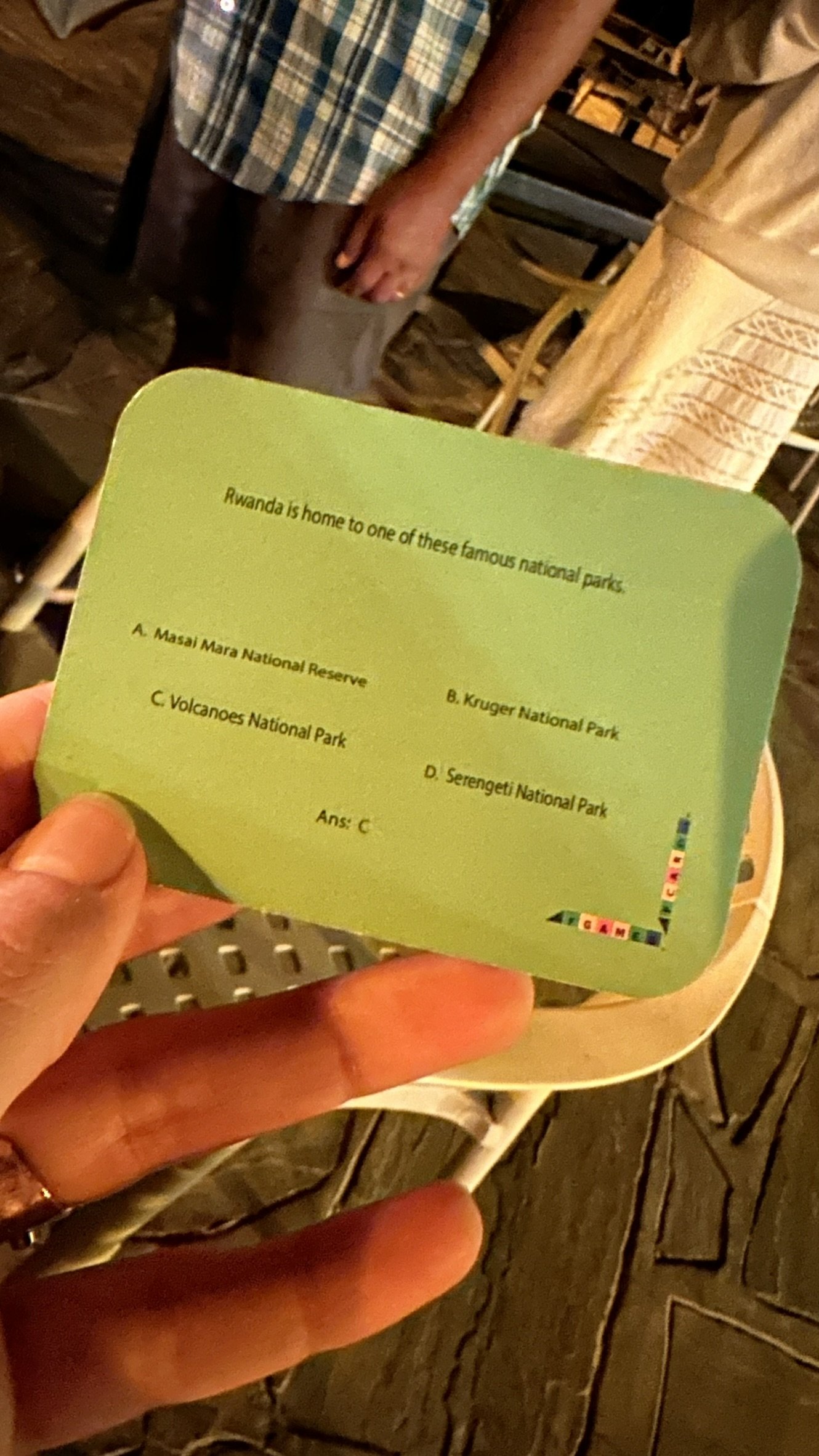
We discovered about this local board game, invented by a couple living in South Africa which we met at this hotel, named AfGames.
They invented it to give more spotlight on their country history and interesting information. To spotlight the beautiful things they have, and not just their problems. I found it a very nice initiative.


✿
Taste Biltong
Biltong is a traditional South African and Namibian dried meat snack. Made from beef, game meats like kudu or springbok, or even ostrich, the meat is cured with vinegar and spices such as coriander, black pepper, and salt before being air-dried. Biltong is often cut into thickstrips and can range from soft and chewy to hard and dry. Originating as a preservation method used by Dutch settlers in the 17th century, biltong is their favourite snack which locals enjoy on road trips, hikes, or paired with beer.

Day 4
Kuiseb Canyon & Walvis Bay
You can find the full Google Maps itinerary for this day at this link.
✿
Drive through the Kuiseb Canyon on the Kuiseb Pass
This day, we are going towards the coast!
But we will dedicate the day to road-tripping across the Kuiseb Pass, which crosses a beautiful canyon with a road that crosses it and you can admire their rock formations.
The Kuiseb Canyon and Kuiseb Pass are significant geographical features in Namibia, shaped by the Kuiseb River. The canyon, formed over millions of years, serves as a natural barrier preventing the southward movement of the Namib Desert's towering red dunes, which can reach heights of over 150 meters.
The Kuiseb River is ephemeral, meaning it flows only during the rainy season, and in January 2005, it reached the Atlantic Ocean for the first time in years. Fish River Canyon is the second largest canyon in the world and the Grand Canyon is a popular destination for hikers. A River That Flows "Backwards": it appears to "flow backwards," moving inland rather than toward the ocean. This happens because the Namibian coast is extremely dry and sandy, causing the river to disappear into the desert before it can reach the sea.
Kuiseb Pass is a mountain pass traversed by the C14 road, offering travellers dramatic views of the canyon's rugged terrain.


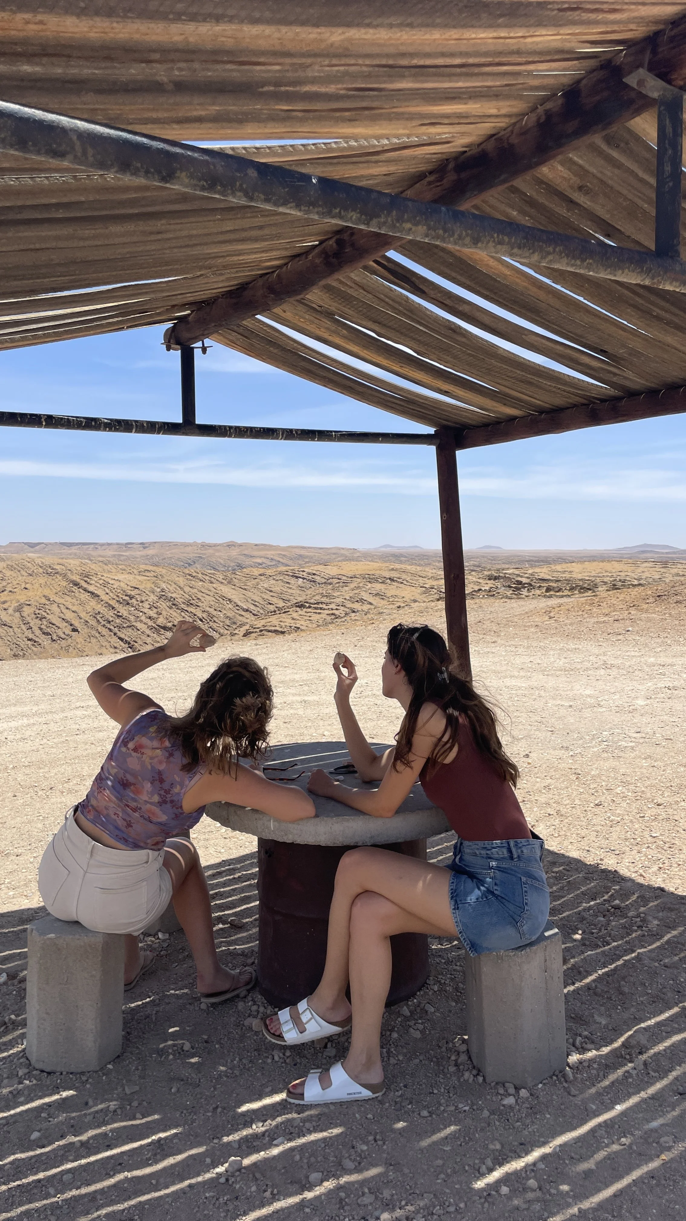
Along the way, we stopped by this very random shelter with tables & chairs to have a picnic. A picnic literally in the nothing. If you wish to find it, then you should go at this spot here, the Eastern Carpcliff Viewpoint.


✎
Flamingos Lagoon in Walvis Bay
Definitely not a must-do (✎), but if you love flamingos then this is definitely the best spot to see them for free. It’s just a tourist stop, nothing special.

PH Marco Cantarini: an italian photographer I met during my trip in Namibia, super randomly in my flight, and who was very kind to share with him all the pictures he took with is professional camera!


✿
Drive to the Seals
DO NOT, I repeat do not, do any tour of seals 6 dolphins with their boats, it’s a scam, you’ll just lose money, as any boat tour around the globe I believe.
Rather, take your car, drive to this point here, then turn towards the point of the bay, you can walk towards the seals (with the right safety distance) and see them yourself, even closer and more authentically than from the boat.


✎
Sleep in Walvis Bay
I think any place is good, I did not like Walvis, it was just good for the next day experiences!
Check the De Baken!


Day 5
Sandwich Harbor & Swakopmund
You can find the full Google Maps itinerary for this day at this link.

If you wish to find my map pins and easily follow them during your trip, follow me on mapstr!
✿ Namib Desert
Before we dive deeper into the Sandwich Harbour drive tour of this day, I feel it’s interesting and important to know where you are!
The Namib Desert is considered the oldest desert in the world, with geological studies indicating it has maintained arid conditions for at least 55 million years, and possibly up to 80 million years. This uninterrupted history of dryness sets it apart from other deserts, allowing for the evolution of uniquely adapted flora and fauna.
Why is the Namib Desert considered the oldest, and to the Atacama Desert in Chile for example? While the Atacama Desert in Chile is known as the driest place on Earth, its desert conditions have existed continuously for an estimated 3 to 10 million years, making it geologically younger than the Namib. Yes, some parts of the Atacama may have had arid conditions dating back 150 million years, though its aridity was not continuous. In contrast, the Namib retains its title as the oldest desert, having remained in a persistent state of aridity for tens of millions of years, unlike the Sahara, which became a desert only about 7 million years ago.

✿
Sandwich Harbour Drive
Are you brave enough to drive on the Sandwich harbor by yourself? Just so you know, it’s possible. You can contact local agencies that usually do these tours (with drivers) and ask to join them with your own pick up and driving. They will allow you to follow them across the tour, and have their assistance for any blockage you might have on the sand, but you will drive. It’s fun!
Otherwise, you can indeed book the tour with a driver, they are very experienced and it’s fun.
If you want to do this experience, you should do it at dawn, cause the tides can increase in the afternoon and make it more difficult to come back at the end of the drive.
You can join for example Okangala Tours & Safaris.


✿
The Sandwich Harbor Dunes
Where the Dunes Meet the Ocean…
During your drive you will exist your 4x4 and enjoy the dunes!
Sandwich Harbour is where the towering dunes of the Namib Desert dramatically plunge into the Atlantic Ocean. This unique landscape gets its name from the way it is “sandwiched” between two extreme environments: the vast, arid desert on one side and the cold, turbulent waters of the Benguela Current on the other.
What makes this place even more fascinating is how the dunes are constantly shifting due to strong coastal winds. The meeting point of sand and sea also produces an eerie, misty atmosphere, caused by the cold ocean air colliding with the desert heat. This fog sustains a variety of desert-adapted life, making it an essential part of the Namib ecosystem.
Historically, Sandwich Harbour was once a lagoon with a natural harbor, used by fishermen and traders, but over time, the advancing dunes have nearly sealed off the area, leaving only remnants of its past.


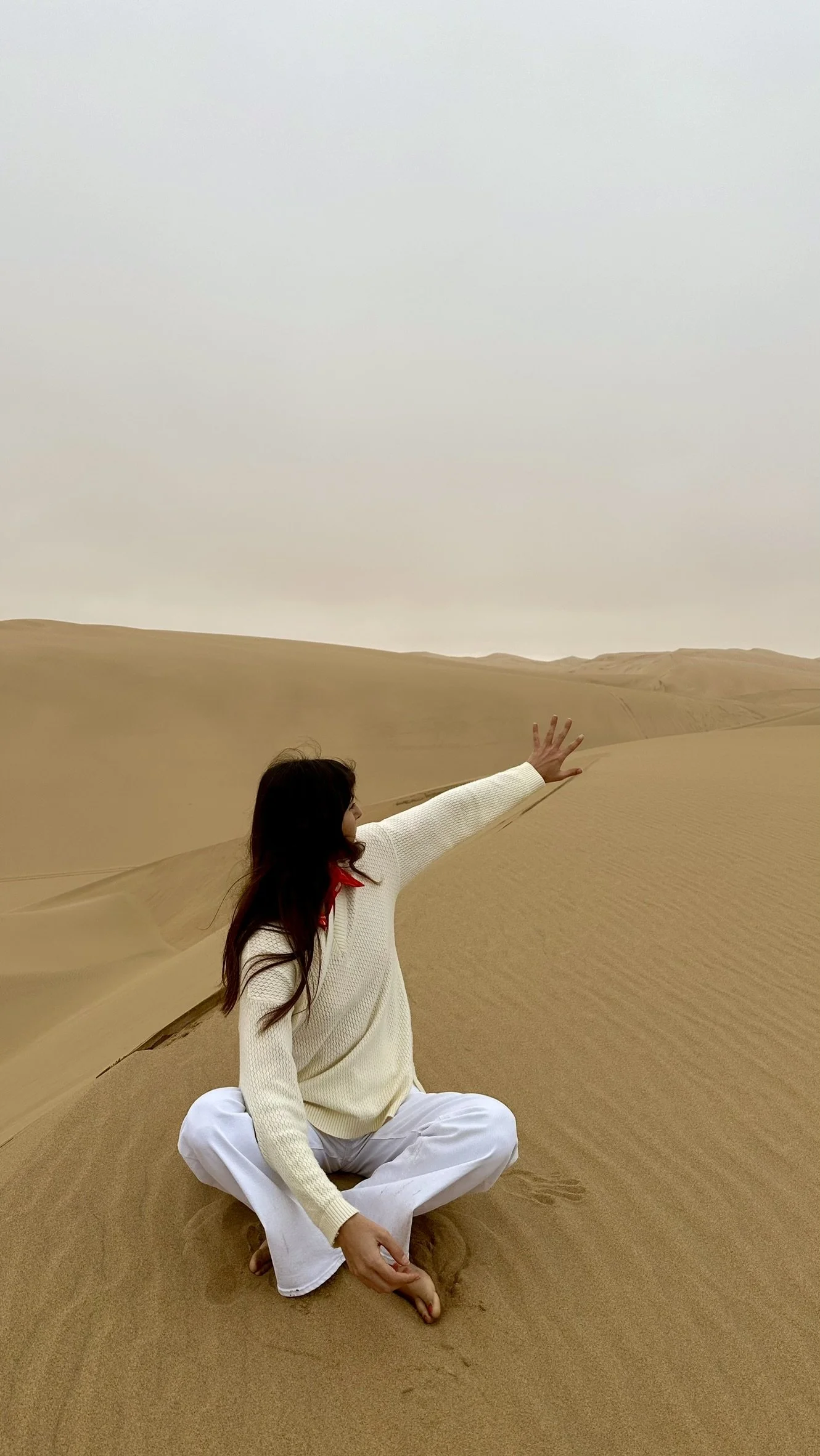
Have you ever tried to climb up a very steep dune? It’s not as easy as it seems!


You can meet some local fauna whilst driving around the dunes:
Oryx (Gemsbok) – The national animal of Namibia, this striking antelope is perfectly adapted to the desert, capable of surviving without direct water by extracting moisture from plants.
Cape Fur Seals – Large colonies of these seals can be found along the coast, often seen basking on the sand or playing in the waves. (just a side sad story, usually when you see sea lions on the shore, it means they are dying… they usually set along the shore because they are ill and cannot swim or find to eat anymore, and they let themselves go).
Brown Hyenas (Strandwolf) – These elusive scavengers patrol the coastline, feeding on washed-up marine life and even hunting small prey.
Jackals – Opportunistic hunters and scavengers, roam the beach looking for food, including seabirds and seal pups (or dying sea lions on the shore…).


✿
The Skeleton Coast
With the Sandwich Harbour tour, you will drive on the so-called Skeleton Coast.
The Skeleton Coast is one of the foggiest places in the world. The thick fog forms due to the clash between the cold Benguela ocean current and the hot desert air, creating an eerie atmosphere that has led to many shipwrecks along the coast.
The Benguela Current, off Namibia’s coast, is responsible for shaping the Skeleton Coast and its infamous shipwrecks. Known as the "killer current," its cold and turbulent waters made navigation treacherous for sailors in the past.
✿
A sand with a magic ingredient: Garnets
Whilst you are there, stop by the beach with your car and enjoy the Garnets sand!
From afar, it might just seem like normal sand you are walking on, but if you watch closely, or try to take a picture with a good phone, you can see the magic!
The garnets present in the sand of Sandwich Harbour are responsible for the pink or reddish hues seen in some areas of the dunes. These garnets are formed in metamorphic rocks and are gradually released through erosion. Over time, they are transported by wind and water, eventually becoming part of the sand deposits.
Garnets are durable and resistant to weathering, which allows them to persist in the sand for long periods. Their vibrant colours, ranging from deep red to pink, contribute to the striking appearance of the dunes.


✿
Enjoy a picnic on the dunes!
The Drive tour agency you will drive with, will organize a small picnic for you also!


✿
See the Salt Mine Lake
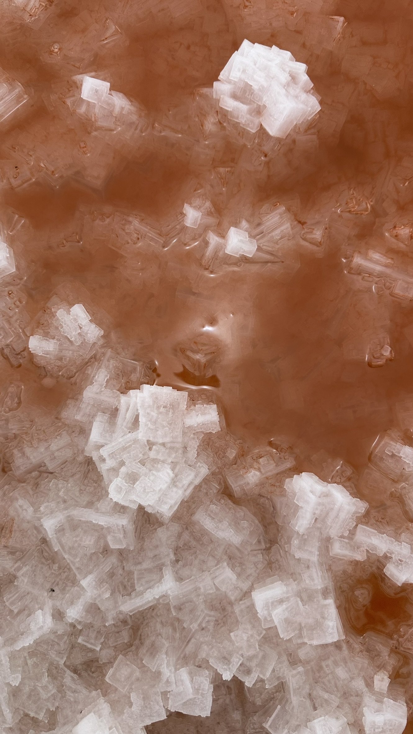
The salt mines of Walvis Bay are one of the largest solar evaporation saltworks in Africa and a fascinating natural attraction. Covering approximately 5,000 hectares, the salt pans produce over 700,000 tons of high-quality salt annually, mainly for export.
One of the most striking features of the Walvis Bay salt mines is the vivid pink and reddish hues of the water, created by the presence of Dunaliella salina, a type of algae that thrives in high-salinity environments. This same algae is responsible for attracting flamingos, which feed on it and develop their distinctive pink coloration. The salt crystallizes along the edges of the ponds, forming intricate white formations that contrast beautifully with the pink water.
The salt is harvested through a natural solar evaporation process, where seawater is pumped into shallow ponds and left to evaporate under the intense Namibian sun, leaving behind pure salt. Visitors driving around the Walvis Bay area can often see large white salt mounds near the processing facilities.
Beyond its industrial importance, the salt mines are a paradise for birdwatchers, as the surrounding wetlands provide a habitat for flamingos, pelicans, and various migratory birds. It’s a surreal and picturesque landscape, making it a must-visit spot for photographers and nature lovers exploring Namibia’s coast.


✎
Spend the night in Swakopmund
✎
Have a drink at Altstadt
Altstadt is the typical german bar with local namibian (german) beers, local namibian (german) menus… it literally looks like Germany, but that’s why it’s so unique to the Namibian culture. If you read all the information in the all-you-need-to-know information above this article, you know why the german culture is so deep in this country. Especially in this western coast, the presence of german descending inhabitants is strong and populates cities like Swakop!


Day 6
Spitzkoppe
You can find the full Google Maps itinerary for this day at this link.

If you wish to find my map pins and easily follow them during your trip, follow me on mapstr!
✿ Visit the Spitzkoppe
Spitzkoppe is often called the "Matterhorn of Namibia" due to its dramatic, pointed granite peaks that rise sharply from the surrounding plains. Located between Swakopmund and Usakos, this granite mountain is around 700 million years old, making it one of the oldest geological formations in Namibia.
You can get there with your car and visit it with your car, driving around these main spots:
You can find Incredible Bushman Rock Art: The area is home to ancient San (Bushman tribe) rock paintings, some estimated to be over 2,000 years old. The most famous site, the "Bushman Paradise", features well-preserved depictions of people and animals.
The Rock Pool: only filled with water in some periods
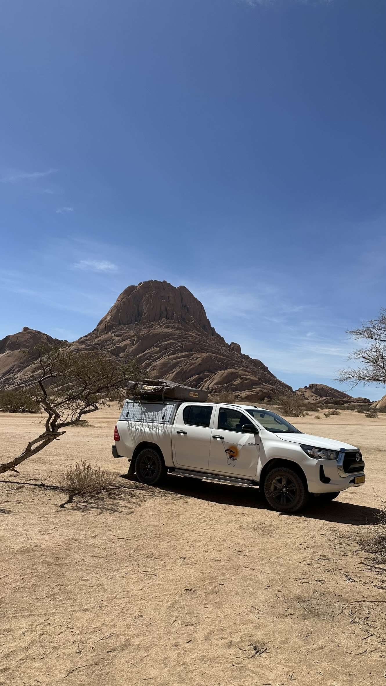


Just a quick moment dedicated to all movie lovers like me:
Dune or Asteroid city?

✿
Shop at the Crystal Market
You’ll encounter many crystals & gemstones markets & small stands along the street, especially along the road to Spitzkoppe. But the best is the Uiba Oas Crystals Market which you find on the way to Spitzkoppe. Go there before visiting Spitzkoppe, as you will find it closed on the way back!
You’ll find cute gemstones earrings and jewelry to gift your friends back home!


✿ Have a quick break, lunch or snack at the Spitzkoppe Camping Café
The Spitzkoppe Camping Is right inside Spitzkoppe, it’s nice to stop by and refresh.
As authentic Italian we could not but play cards in our break! ahah
You can also decide to sleep here!
We spent the night into an accommodation close by Spitzkoppe but I don’t want to suggest it as it had quite many problems!


Day 7
Twyfelfontein
You can find the full Google Maps itinerary for this day at this link.

If you wish to find my map pins and easily follow them during your trip, follow me on mapstr!
Start your roadtrip towards north, towards Palmwag! We loved this moment as we were lucky to see a Giraffe during our road trip right by the road… it was magical! Though, the landscapes were also beautiful so I am sure even without a lovely giraffe staring at you, you will enjoy this drive!


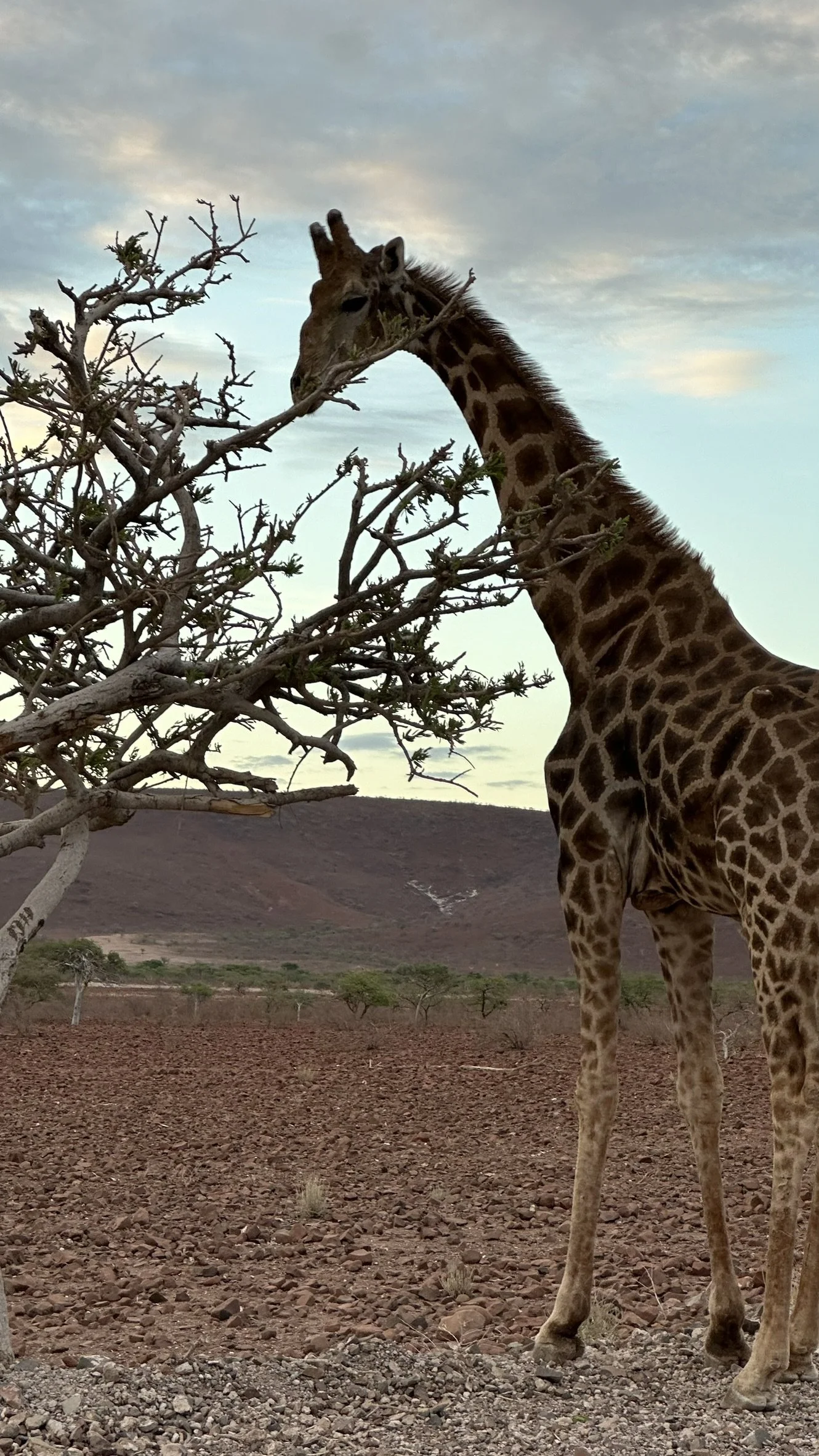


You’ll be driving through the Damaraland Region. Let’s discover more about this…
✿ Daramaland Region
Damaraland is a stunning, remote region in northwestern Namibia and is home to the Damara people (or Bushmen), one of Namibia's indigenous groups.
One notable aspect of Damaraland’s wildlife is the presence of rhinos. Bushmen living in the Damaraland region used to kill only White Rhinos, using a poisonous plant, known as Iphobia Damarana, that has a toxic effect and which the Bushmen have historically used to poison animals for hunting. Black Rhinos—specifically the bush-eating black rhinos - on the opposite, used to feed on the same toxic plant, this is why they could not be hunted by humans, they would be immune to their poison.
The Damara people’s resourcefulness in the harsh desert environment is impressive. For instance, they use ostrich eggs as containers, where they cook the contents, consume the egg, and then leave the shell for ants to clean, using the natural process to avoid the buildup of pressure. They also utilize turtle shells as drinking cups, showcasing the practical use of natural materials.
Preserving food is another important aspect of survival in Damaraland. Salt is used to preserve freshly hunted meat, and it is also common practice to hang meat on trees to dry. Additionally, the Damara people are known to follow elephants to find water, as elephants typically travel to waterholes, ensuring access to water in an otherwise dry region. Another way to find water, was to follow the behaviour of giraffes. When a giraffe lowers its head, it’s a sign that it is drinking, as the giraffe bends its neck only during this action, making it a recognizable behavior for the Damara people.
The name "Damaraland" itself is derived from the word “Dama”, meaning "stepping around." This name was given by the Damara people after they observed the footprints of the Damara people in the sand. They used to walk stepping around, sort of like a dance movement. This is why, today, Dama also refers to a traditional dance, where the dancers move in a circle, stepping around in rhythmic movements, embodying the spiritual and social connection of the community.
The Damara language, with its distinctive clicks, is another unique cultural feature. The clicks, known as the Khoen Khoen language, are an integral part of communication, and this fascinating language is still taught in schools and spoken across the Damaraland region today. One common phrase is “Matissa”, which means "How are you?"—a greeting that encapsulates the rich cultural life of the Damara people.
✿ Brandberg White Lady Café
Stop by this cafè to drink something and buy something, they have some souvenirs.
Or eat your sandwiches in front of it like we did! Ahaha


✿ Shop local bags & souvenirs at street stands
Between Uix & Khorixan, along your roadtrip, on the C-35 you will find many stands with locals selling handmade bags with their prints & patterns. They looked very authentic and beautiful! As you know I usually don’t love buy souvenirs in shops, but I prefer these small local shops to do so!


ps: MAKE SURE TO VISIT THE FOLLOWING PLACES BEFORE 5pm - They close afterwards!
✿
See the Petrified Forest
The Petrified Forest is a geological site is known for its extensive collection of ancient, fossilized trees, some of which are estimated to be around 280 million years old.
The forest is not a typical forest but rather a collection of large, ancient tree trunks that have turned into petrified wood. The process of petrification occurs when organic material (like wood) is gradually replaced by minerals over time, preserving the structure of the trees. In the case of the Petrified Forest in Namibia, the trees are believed to have lived during the Permian period, when the area was once a lush, forested region, quite different from the arid desert environment it is today.
The trees at the site were originally part of a forest that existed during the Permian era, long before dinosaurs roamed the Earth. As the trees died, they fell and were buried by volcanic ash and sediments. Over millions of years, groundwater rich in minerals percolated through the buried trees, slowly replacing the organic material with minerals like silica, iron, and calcite, resulting in the petrified wood we see today.
The site contains several fossils of ancient plants and animals, making it a valuable location for paleontologists and geologists.


✿
Visit Twyfelfontein
Twyfelfontein, located in Namibia's Damaraland region, is a UNESCO World Heritage Site renowned for its over 2,500 rock engravings, which date back 6,000 to 2,000 years. These intricate petroglyphs, created by the indigenous San and Khoikhoi peoples, depict a wide range of animals like elephants, giraffes, and lions, as well as abstract symbols, suggesting their spiritual and cultural significance.


✿
See the Organ Pipes of Twyfelfontein
The Organ Pipes near Twyfelfontein are a group of hexagonal basalt columns that rise sharply from the ground, creating an otherworldly and striking landscape. This formation gets its name because the columns resemble the pipes of a massive pipe organ.
The Organ Pipes were formed around 120 million years ago during a volcanic eruption. As molten basalt lava flowed and cooled, it solidified and contracted, causing the formation of these regular, hexagonal cracks. Over time, weathering and erosion have further exposed and shaped the columns, creating the impressive structure visible today. The columns vary in size, with some reaching up to 5 meters in height.

✿
Spot the Welwitschia mirabilis
It is perhaps one of the most extraordinary plants in the world and is iconic to Namibia's desert landscape. It is found primarily in the Namib Desert, where it thrives in the extreme conditions of the coastal desert, particularly in areas of low rainfall and high temperatures.
It’s often referred to as a "living fossil" due to its ancient origins. It is considered one of the oldest living plant species, with some specimens estimated to be over 1,000 to 2,000 years old. The plant has been around for more than 200 million years, making it one of the earliest survivors of a dry desert environment. The leaves can grow up to 4 meters long and are often twisted and curled due to the wind and the harsh conditions. Welwitschia has an extensive taproot system, which allows it to reach underground water sources in the desert. This system is critical for its survival in the arid conditions of the Namib Desert. The plant also takes advantage of the fog that rolls in from the ocean. Namib Desert fog is a vital moisture source, and Welwitschia can absorb water from the fog through its leaves, helping it survive during the dry periods between rains.

✿
Sleep in Hoada Campsite
They have both a place for your 4x4 with a tent to camp, but also camp tents already equipped which are also very nice. Find it here.
You have a kitchen and bathroom all created within the rock formations of the area!


Day 8
Etosha National Park - Okaukuejo
You can find the full Google Maps itinerary for this day at this link.

If you wish to find my map pins and easily follow them during your trip, follow me on mapstr!
On the way to Etosha, we have lengthened our drive because we did a short visit to a friend of mine living in Namibia and working in a local farm, having her own horses & one zebra she rescued from the park after she was abandoned.
This farm though is private and you won’t be able to go there, I am simply posting some pics here for my personal memory!
Even if you won’t be able to go, the area and landscapes around the farm, where we drove, were beautiful and definitely different than what we had seen so far, so if you still want to visit the area, it’s the Kunene Region.


✿
Etosha National Park
We will spend 2 full days in the Etosha park. I honestly do think it is enough, after a few days I get bored in national parks, as you always do the same thing over and over. Especially if you have been in other national parks or savannahs across the world, you have already experienced it and it’s almost always the same!
Anyway, we will start from Okuakuejo, the main entrance, and then move to Halali. Some also go all the way to Namutoni
From my personal experience, it’s better to drive your own car inside the park, and pay for a local guide to drive your car and bring you to the relevant spots, the ones you will ask for! We met this local Etosha park guide when we were there (suggested to us by some locals we met in Namibia). I will share here with your his contact: Amon +264813537847.
Why is it better? First, it’s so much cheaper and you value way more the investment you already made in your 4x4 rental car. Second, he is connected to all other local guides, and they communicate via whatsapp sharing salient places where they see animals real time, so he knows where to go to chase animals and see them. If you would have to do it yourself, you’d be lost and you’d not know where to go, drive and find animals. You can tell him your Italian friend Chiara gave you his contact number, I am sure he will remember us! Ahah :) Just for your information, his service was around 700 NAD total (35€ ish) for around 4-5 hours tour drive in the park.
✿
Drive to the Anderson Gate to enter the Etosha park
Some information:
The park gate entry costs around 150 NAD per person per night/day + 100 NAD per vehicle.
You should always make sure to enter the park by sunset (which is the closure time). This changes across the year, because the sunset is always at a different time. It might close at 5 pm or at 19.30 pm. So call your campsite and ask for information before getting there!
THROW AWAY all plastic bags you have with you in your car. At the entrance, (but also at the exit of the park, they will check your car and fine you if you have plastic bags with you!
THROW AWAY any meat you have. Biltong (and dried meat is fine), but not fresh meat. They will also fine you for that!
Now that you know everything, get your binoculars and start driving around the park for your safari! If you decide to have a local guide, then he will probably tell you to pick him up at the Anderson gate :) So pick him up and start!
There is no rule of how to see animals, they move around constantly, so do not expect to find favorite spots to go for sure and find animals! Though, I have some key guidelines that might help you:
Go to Waterholes. There is one Waterhole in Okaukuejo, and one in Halali. They are both quite big, but in general you simply can write on google maps and find waterholes near you.
You can check this tree here, our guide told us is a favorite spot for lions, and in fact we saw a family getting shadow under this tree right in the middle of their meal!


Sharing here also some other pictures:
PH Marco Cantarini: an italian photographer I met during my trip in Namibia, super randomly in my flight, and who was very kind to share with him all the pictures he took with is professional camera!


✿
The Etosha Pan
Drive to the Etosha Pan.
The Etosha Pan is a vast, shimmering salt pan located in Etosha National Park. Spanning approximately 4,800 square kilometers, it is one of the largest salt pans in Africa and is so large it can even be seen from space.
The name "Etosha" means "Great White Place" in the Oshiwambo language, a reference to the blindingly white, cracked surface of the pan, which is covered in layers of salt and mineral deposits. Once part of a massive prehistoric lake that dried up thousands of years ago, the pan is now mostly a dry, barren expanse, except during the rainy season when it briefly transforms into a shallow lake, attracting thousands of flamingos, pelicans, and other migratory birds.


✿
The Big 5
The Big Five of Namibia are the lion, leopard, elephant, rhinoceros, and buffalo, originally named by hunters as the most dangerous and challenging animals to hunt on foot.

✿
The Ugly 5
The Ugly Five of Namibia may not be the most beautiful animals, but they each play a crucial role in the ecosystem.
The Marabou Stork, with its bald pink head, hunched posture, and fleshy throat pouch, looks almost vulture-like as it scavenges for carrion.
The Warthog, with its wart-like facial growths, coarse bristles, and curved tusks, has a rough appearance but is a surprisingly fast runner.
The Spotted Hyena is often seen as unattractive due to its sloping back, patchy fur, and eerie laugh-like vocalizations, though it is a skilled hunter and scavenger.
The Lappet-Faced Vulture has a wrinkled, bald red head and powerful hooked beak, making it look menacing as it tears into carcasses.
Lastly, the Wildebeest, often described as looking like it was "built from spare parts," has a large head, humped shoulders, scruffy mane, and thin legs, giving it an awkward, mismatched look despite being a strong migratory animal.

✿
Spend the night at Okuaukuejo Campsite from NWR
This was our favorite campsite within the Etosha part, for its services, beauty.


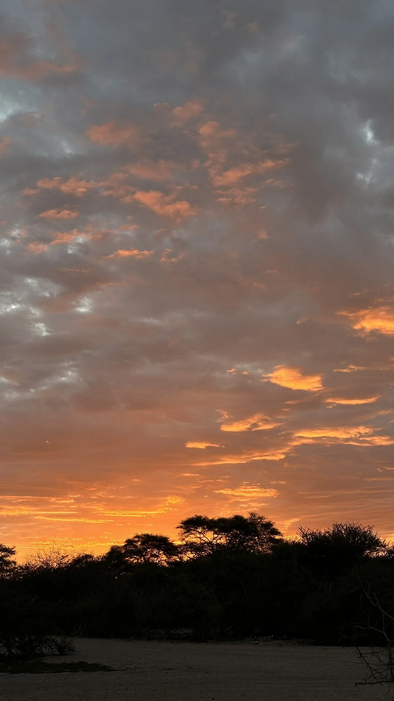


Day 9
Etosha National Park - Halali

If you wish to find my map pins and easily follow them during your trip, follow me on mapstr!
✿
Chasing Leopards
I’d suggest you to also book a guide here, you definitely have more chances to find leopards!
Leopards are mostly present in the Etosha Park area comprised between Halali and Namutoni. So if you drive around this are you have some chances to see them!
PH Marco Cantarini: an italian photographer I met during my trip in Namibia, super randomly in my flight, and who was very kind to share with him all the pictures he took with is professional camera!


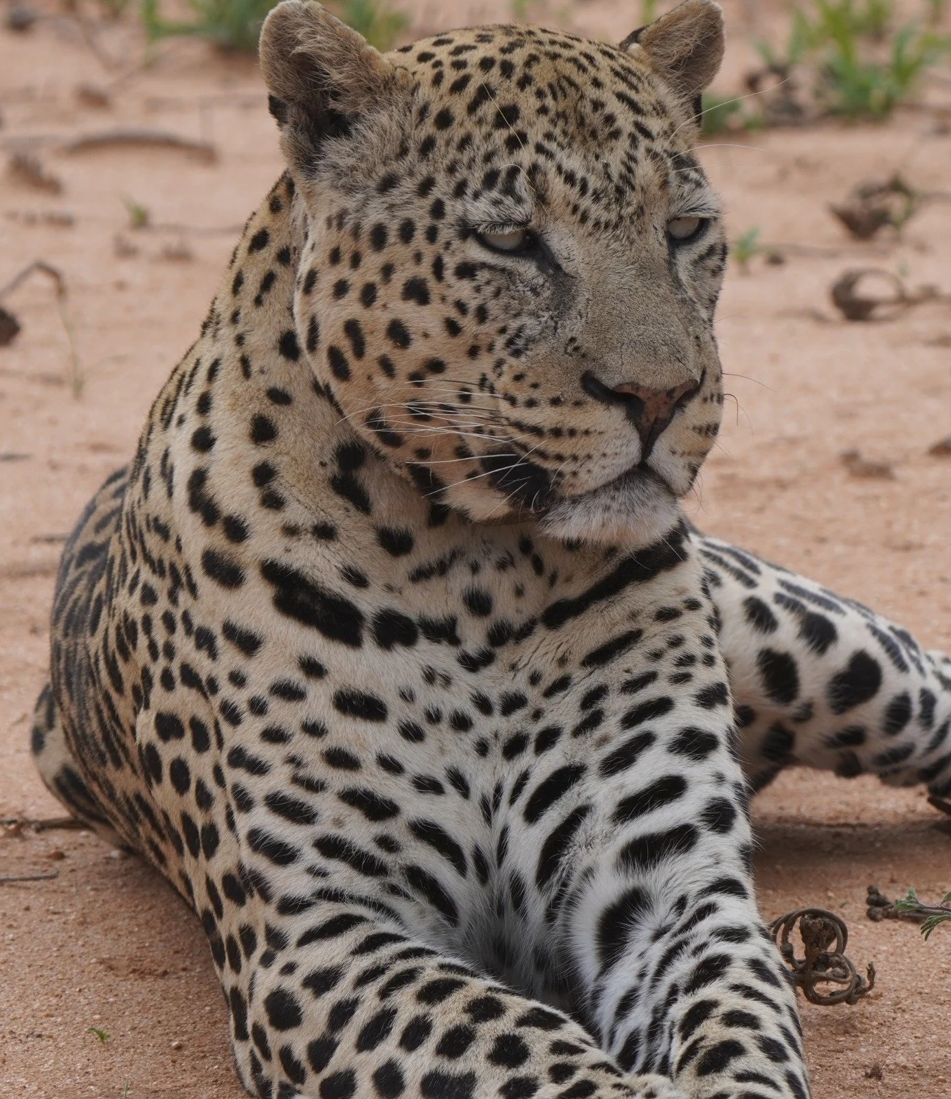

Since we didn’t want to miss the chance of seeing leopards… we dressed like them! Random

✿
Spend the night in Halali Campsite from NWR
Day 10
The luxury of Namibia

If you wish to find my map pins and easily follow them during your trip, follow me on mapstr!
Shall we, for one day, after many days sleeping in a tented car, enjoy some of the luxury that’s been developed (even if I am not such a fan of it…) in Namibia?
Let’s do it!
✿
Enjoy some rest at Otjiwa Safari Lodge
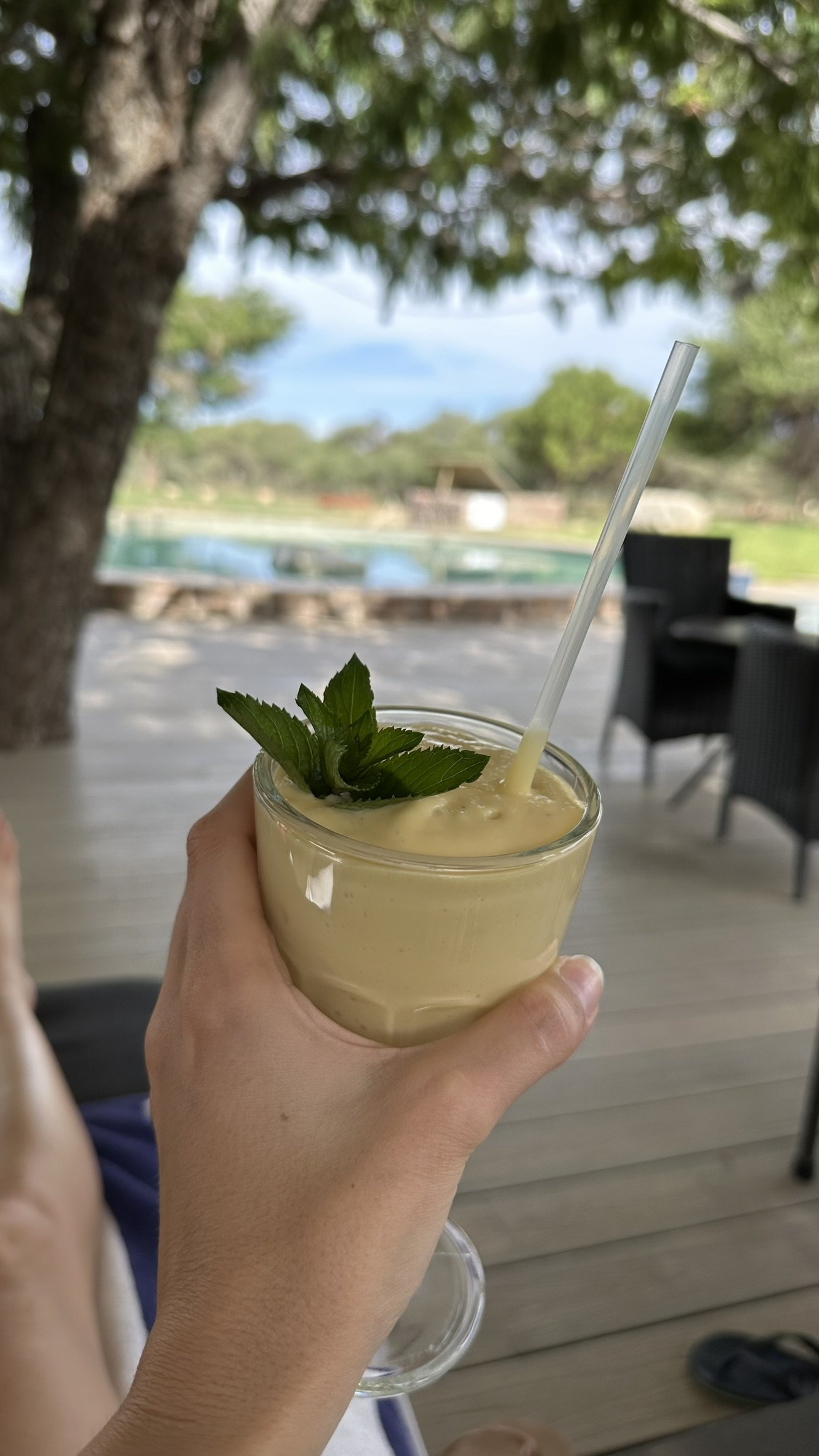
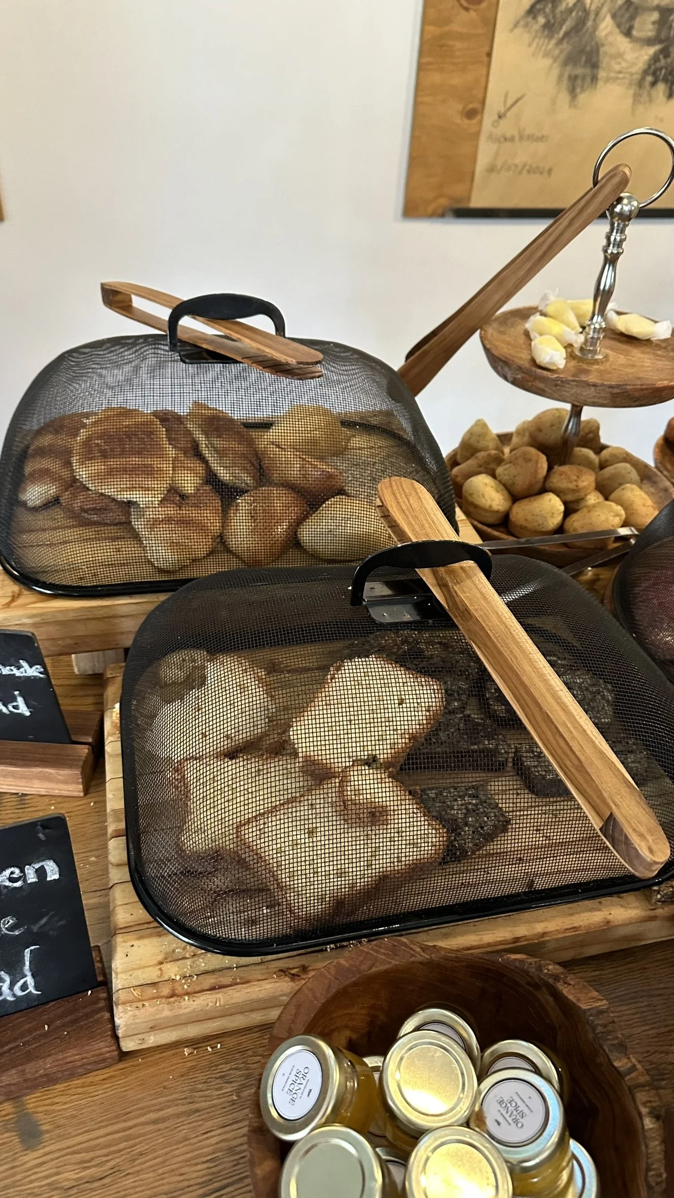
It was my birthday, and I wanted to spend it in a beautiful place, so we just did! We chose this place, Otjiwa Safari Lodge and I have to say, it wasn’t the maximum of luxury, but for Namibia, it was great!
BUT WHY did we choose this place? Not only because it was beautiful, and had many experiences you can do (check the next paragraphs), but also because it was on the way to Windhoek, for our flight back home!




✿
Horse Back Ride & Spa Massage
The Hotel organizes horse back riding around the area in the desert, you should definitely do it!
Plus, they have a spa and can make massages, even in two if you are with someone! We enjoyed it a lot, it was the best way to end our trip in Namibia!


✿
Dine here
The food wasn’t great, but the location and the atmosphere definitely cover up for this!
It was definitely special for my birthday!


✎ Shop there
They also have thier own shop and you can basically buy anything you see around…
I was in love with their wooden bowls to keep fruits & veggies & bread, and they sold it to me! Their items were definitely very high quality compared to the rest of things you could find in Namibia, so it was worth the expense!


✎ Outjo Bakkery
By the way, on the way from Etosha to the hotel, we stopped by this big Café and shop. Very touristic but useful in case you want to buy some last few souvenirs! They have great wooden pieces!


